GPS Base
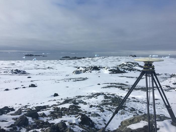
A GPS base station deployed on Joinville Island overlooks a series of snow-covered raised beaches and moraines. The GPS survey was used to determine the elevation of the beach ridges, which when combined with their ages can be used to reconstruct the late Holocene record of sea-level changes along the northern Antarctic Peninsula. The record of sea level will provide insights into the glacial history and Earth structure beneath the Antarctic Peninsula. Photo credit: Alex Simms.